Could You Survive a Locate Audit Tomorrow?
)
Imagine this scenario. It’s a Tuesday morning. A contractor hits a gas line during excavation. Nobody is injured, but the line is damaged, service is disrupted, and the investigation starts immediately.
Within hours, someone is asking for the locate documentation. Specifically, they want to know: Who performed the locate? When was it completed? What equipment was used? Where exactly were the marks placed? Was the locate accurate? Is there photographic evidence of the mark-out? Was the positive response filed correctly? Was the locator qualified and current on their training?
How long does it take your organization to answer all of those questions with documented proof — not from memory, but from an actual audit trail?
For most locate contractors and utilities, the honest answer is hours, possibly days, and even then there are gaps. The documentation exists in fragments: some in a ticket management system, some in a filing cabinet, some in a locator’s phone photos, some in an email chain, and some only in the locator’s memory.
For a growing number of operators, the answer is different. It’s instant. Every data point, from GPS coordinates to completion photos to equipment records, is available in a single, timestamped, audit-ready package. These operators don’t scramble when a damage claim arrives. They pull up the record and respond.
What Auditors and Investigators Actually Look For
Understanding what constitutes a defensible audit trail starts with understanding what investigators are evaluating. In a damage investigation, the documentation bar is higher than most operators realize.
Investigators and auditors are looking for chain-of-custody documentation that tracks the ticket from receipt through assignment, completion, and positive response. They want GPS-verified evidence of mark placement, not a written description of where marks were placed, but coordinate data that can be compared to the actual damage location. They expect timestamped photo documentation showing the site before, during, and after the locate. They want equipment calibration records from the day of the locate. And they want locator qualification records that confirm the person who performed the work was trained and certified.
Each of these elements serves a specific purpose in the investigation. The GPS data establishes whether the locate was accurate relative to the actual utility location. The timestamps establish whether the locate was performed within the required window. The photos provide visual evidence of the mark-out quality. The equipment records establish whether the locator was using properly calibrated tools. The qualification records establish whether the operator was competent to perform the work.
When any of these elements is missing, the organization’s position in the investigation weakens significantly. And in most operations, at least some of them are missing.
The Reconstruction Problem
The fundamental issue with paper-based and fragmented documentation systems is that they require reconstruction after the fact. When a damage event occurs and documentation is requested, someone has to go back and assemble the record from multiple sources.
This reconstruction process is slow, error-prone, and often incomplete. The locator may have moved on to another employer. The phone they used for site photos may have been replaced. The handwritten field notes may be illegible. The positive response may have been filed correctly in the ticket system but without the supporting evidence that gives it credibility.
Every gap in the reconstructed record is an opening for liability. And the unfortunate reality is that damage investigations often happen weeks or months after the locate, by which time the details that would have been easy to document in real time are impossible to reconstruct with certainty.
What Audit-Ready Documentation Actually Looks Like
An audit-ready locate documentation system is one that captures every element of the audit trail automatically, as a byproduct of the locate work itself, without requiring any additional effort from the locator.
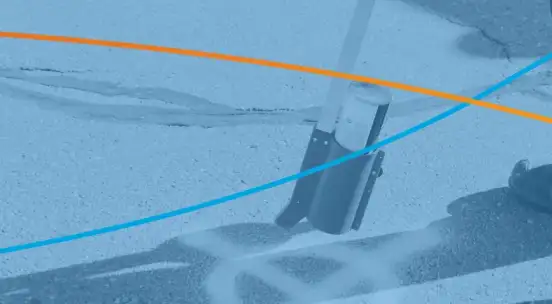
In practice, this means that when a locator performs a job, the system captures GPS coordinates of every mark placed, photos of the site with automatic geotagging and timestamps, depth readings and utility identification data, equipment serial numbers and calibration status, locator identification and qualification records, ticket assignment and completion timestamps, and positive response filing with supporting evidence.
All of this data is captured in real time, during the locate, and stored in a single, linked record that can be retrieved instantly at any point in the future. There is no reconstruction step because there is nothing to reconstruct. The documentation was created as the work was performed.
The Insurance and Contract Impact
Beyond the immediate damage investigation scenario, audit-ready documentation has tangible business benefits. Insurance providers are increasingly evaluating the quality of locate documentation when setting premiums and processing claims. Operators who can demonstrate systematic, GPS-verified documentation across their entire operation are in a different risk category than those relying on paper-based systems.
Contract retention is another dimension. Utilities evaluating their contracted locate providers are beginning to require documented proof of locate quality as a standard contract deliverable. The contractor who can produce a comprehensive audit record on demand is in a fundamentally stronger position at renewal than the one who says “trust our process.”
The regulatory direction is also clear. Positive response requirements, locate quality audits, and documentation standards are tightening across jurisdictions. Operators who build audit-ready systems now are positioning themselves for a regulatory environment that is only going to become more demanding.
The Time to Build Your Audit Trail Is Before You Need It
The most important thing about locate documentation is that it cannot be created retroactively. You either captured the GPS coordinates, the photos, the timestamps, and the equipment records at the time of the locate, or you did not. There is no way to reconstruct this data after the fact with any credibility.
This means the time to implement an audit-ready documentation system is before a damage claim arrives — not after. Every locate completed without proper documentation is a liability exposure that cannot be addressed later.
The operators who sleep well are the ones who know that every locate on their operation is documented, timestamped, GPS-verified, and retrievable. They are not hoping their documentation will hold up. They know it will.
|
See how TerraFlow builds a complete audit trail on every locate — automatically. Visit www.terraflow.ca/demo to book a walkthrough. |