GPS-Enabled Locating: Best Practices for Accurate Records and Efficient Workflows
)
GPS-Enabled Locating: Best Practices for Accurate Records and Efficient Workflows
By Kieren Tinning, TerraFlow Geomatics
Canadian locators face increasing pressure every day.
Deliver faster results. Maintain accuracy. Manage growing infrastructure complexity. Balance thorough field investigation with tight timelines. All while facility owners struggle with incomplete or outdated records that make your job harder and riskier.
GPS-enabled locating tools offer real solutions. But only when implemented thoughtfully.
This article outlines practical strategies for leveraging GPS technology to improve locate accuracy, generate reliable records, and build safer workflows.
GPS Does More Than Capture Coordinates
Many locators view GPS as just mapping technology. Useful, maybe. Not essential for daily work.
This misses the bigger picture.
Real-time positioning guidance means navigating directly to previous locate positions without searching through sketches or relying on memory. Callbacks become faster. Seasonal work gets easier. Covering someone else's route stops being guesswork.
You can verify you're marking the right asset in the right location by comparing your current position against facility records or previous locates. Fewer mismarks. Fewer damages.
Field applications that support both locate and as-built workflows provide immediate access to construction records at the job site. Installation photos. Design documents. Depth measurements from the original build.
This historical context helps you understand what should be underground and spot discrepancies between records and field conditions.
GPS systems capture locate paths, mark positions, and site conditions without manual measurements or post-job data entry. No transcription errors. Significant time savings.
Walk-back capability means returning to exact previous mark positions for re-marking. Seasonal changes, post-construction verification, degraded marks—instead of re-locating from scratch, you're verifying and refreshing existing work.
Timestamped, georeferenced records demonstrate locate thoroughness. This protects you and your client when questions arise about completeness.
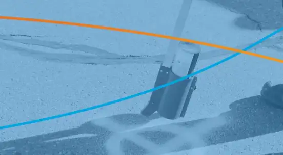
Equipment Integration Matters
Modern GPS-enabled locators integrate positioning data directly into your electromagnetic locator.
No juggling multiple devices.
Systems like the Radiodetection 8200SG and Vivax Metrotech RTK Pro offer integrated solutions that combine electromagnetic locating with high-accuracy GPS positioning in a single unit. Mobile applications designed for utility locating—TerraFlow Mobile runs on tablets, phones, or rugged devices—let crews capture GNSS data on site using standardized symbols while attaching photos.
For work in remote areas with limited or no cellular coverage—the far north, oil sands regions—add-on GPS receivers like EOS or Trimble units extend your system's capabilities. These external receivers provide reliable positioning where built-in GPS struggles.
When evaluating tools, verify accuracy appropriate for utility locating. Typically 1-3 meters for standard work, sub-meter for critical applications. Check reliability in challenging environments like urban canyons or tree cover. Confirm integration with existing equipment. Make sure it captures data without slowing your locate process. Verify it functions in remote areas where cellular connectivity is limited or unavailable.
Establish Consistent Protocols
The most common mistake is inconsistent data collection.
Your team needs standard practices.
Define what data points matter: utility crossings, changes in direction, depth measurements, surface features, obstacles. Capture these consistently on every locate.
Decide whether you're capturing every few meters along a continuous run or only at key points. Consistency matters more than capturing everything.
Use standardized symbols and naming conventions. If one technician marks a valve as "V-123" and another uses "Valve #123," your records become difficult to search and analyze.
Pre-set templates within your field application enforce consistency. All record capture becomes accurate, repeatable, and reliable across your entire team.
Verify GPS signal quality before starting. Most systems show accuracy indicators. Don't capture data when accuracy is poor unless you flag it for later verification.
Walk-Back Functionality
One of GPS technology's most practical features is walking back to previous positions.
Seasonal re-marking: Return to spring locate positions in fall without re-locating.
Post-construction verification: Check if utilities were avoided as marked.
Quality audits: Supervisors verify technician accuracy by walking back to marked positions.
Training: New technicians follow experienced locators' paths to understand optimal techniques.
To use walk-back effectively, maintain your device's GPS database. Ensure previous locates are accessible in the field, not just archived in the office.
Document Challenging Conditions
GPS-enabled systems let you capture photos, notes, and audio tied to specific locations.
Document areas where signal quality was poor or locating was difficult.
Note suspected unmapped utilities or discrepancies between records and field findings.
Record surface conditions that may affect future locates—construction, new pavement, landscaping changes.
Add recommendations for facility owners regarding record updates or field verification needs.
This documentation protects you professionally and helps improve system records over time.
Capture Once, Use Multiple Times
Traditional workflows create duplicate effort.
Locate the utility. Mark it. Sketch it. Transcribe data into multiple systems.
GPS-enabled workflows eliminate this redundancy.
When you capture locate data digitally in the field, that same information feeds work order systems to prove completion and document time on site. It updates GIS databases with facility owner records. It generates standardized locate documents and sketches. It feeds analytics systems to measure productivity and identify high-risk areas.
Purpose-built field applications streamline this significantly. TerraFlow Mobile captures data once in the field and automatically distributes it to multiple downstream systems—GIS platforms, CAD drawings, utility sketches, and raw data repositories. No manual re-entry. Fewer errors.
Applications that support both as-built and locate workflows create a continuous record lifecycle.
Construction crews capture installation data during the build phase. That data becomes immediately available to locators during future locate requests. You can reference original installation photos, depth measurements, and construction notes directly on your mobile device while in the field.
This context significantly improves locate accuracy and confidence.
Work with your software vendor to establish automated data flows rather than manual re-entry.
Prioritize Accuracy Initially
When first implementing GPS-enabled locating, teams often rush to capture data quickly.
This creates poor-quality records that undermine the entire system.
Take time to capture accurate positions, even if it initially slows you down. Verify that marks, GPS positions, and field observations align. Review data before leaving the site when possible. Establish quality benchmarks and measure against them.
Speed comes naturally as technicians become proficient.
Prioritizing accuracy from the start builds good habits and trustworthy records.
Design for Future Users
Your field records won't just be used by you.
Other locators will reference them. Facility owners. Engineers. Excavators. Potentially years later.
Design records with this in mind.
Capture nearby landmarks, offset measurements from permanent features, and surface references that will remain identifiable over time. Use clear, professional terminology and standard symbols. Avoid abbreviations that might be unclear to others.
Include photos showing the broader site context, not just close-ups of marks.
Future users need to understand the environment.
If you're uncertain about something, document it clearly. "Approximate location based on limited access" is more valuable than a precise-looking mark that might be wrong.
Version Control
As sites change and records get updated, maintaining version control becomes essential.
Your system should timestamp all captures with date, time, and technician identification. Preserve historical data rather than overwriting it. Allow users to view current conditions alongside previous locates. Flag when records conflict or show significant changes.
This historical record helps identify patterns—utilities that drift from documented positions, for example—and protects against liability questions.
Bridge Field and Office Systems
The greatest efficiency gains come from seamless integration between field collection and back-office systems.
Cloud-based platforms act as a bridge between field teams and enterprise systems. They provide scalable storage, advanced drawing functionality, and seamless data exchange between field apps and GIS or CAD platforms.
Work with your software providers to establish automated synchronization.
Data flows from field devices to central systems without manual intervention. Field technicians access current facility records while office staff see real-time field updates. Data exports in formats compatible with GIS, CAD, and work management systems. Automated checks flag incomplete records, positional errors, or missing required data before records are finalized.
Establish Clear Workflows
Technology only works when people use it consistently.
Document your workflows.
How do technicians access site history, previous locates, and facility records before the locate?
When and how is data captured during the locate?
What's the minimum required information?
How is data reviewed, approved, and distributed to stakeholders after the locate?
What happens when GPS accuracy is poor, or conflicts arise between records and field findings?
Train all team members on these workflows. Update them based on field feedback.
Plan for the Canadian Environment
Canadian locators face unique challenges that impact GPS effectiveness.
Cold affects battery life and device operation. Carry backup batteries and keep devices warm.
Signal interference in city cores may require alternative positioning methods or post-processing.
Remote areas may lack cellular connectivity for real-time data sync. Ensure your system works offline.
Forest cover, valleys, and northern latitudes can impact GPS accuracy. Understand your equipment's limitations.
Measure Success
Track metrics that demonstrate value.
Compare time spent per locate before and after GPS implementation.
Measure how walk-back functionality reduces callbacks.
Track discrepancies between field findings and existing records.
Monitor whether improved records correlate with fewer strikes.
Survey facility owners and excavators on record quality and usefulness.
Share these metrics with your team to demonstrate the value of thorough data capture and build buy-in for the process.
Moving Forward
GPS-enabled locating represents a significant shift from traditional methods.
Success requires more than just buying equipment. It demands thoughtful implementation, consistent practices, and ongoing refinement.
Start small. Pilot GPS tools with your most experienced technicians. Establish proven workflows. Then scale across your organization.
Invest in training. Not just on equipment operation, but on why quality data capture matters and how it protects everyone involved in ground disturbance.
Remember that GPS technology serves the locator, not the other way around.
The goal is to help you locate more accurately, work more efficiently, and contribute to safer excavation practices.