The Digital Twin Revolution: Why Utilities Can't Modernize Without Accurate Base Data
)
The Digital Twin Revolution: Why Utilities Can't Modernize Without Accurate Base Data
Utilities are preparing to spend $2 trillion modernizing North American grids by 2030. Digital twins—virtual replicas of physical infrastructure—promise to transform operations, predict problems, and integrate renewable energy.
But there's a critical problem: the digital twin is only as good as the data feeding it.
The Data Crisis Breaking Digital Twins
Here's what utilities discover after implementing new digital twin platforms: the model doesn't match what's in the ground. Lines appear connected in the system but aren't physically connected in the field. Transformers show up blocks away from their real locations. Equipment replaced years ago still appears in the database with original specifications.
Many utilities still rely on paper maps converted to digital without field verification—resulting in accuracy errors of 30 feet or more. GPRS reports finding lines over 30 feet from their documented positions. When Singapore investigated their underground utility data, they found "virtually all stakeholders are aware that much of the available information is unreliable."
Legacy data carries decades of accumulated errors: hand-drawn as-builts were approximations, CAD-to-GIS conversions introduced transformation errors, construction deviations went undocumented, and infrastructure changes weren't recorded. This "as-designed versus as-built" gap plagues every utility that migrated from paper to digital without field verification.
Why Topology Errors Break Everything
Modern GIS platforms enforce strict topology rules—which asset types can connect, where junctions are required, how networks trace. When utilities migrate legacy data, they discover thousands of topology errors that were invisible in old systems.
If these errors remain unresolved, digital twins can't build accurate subnetworks, traces return invalid results, operators can't determine which customers are affected by outages, and emergency responders can't identify which valves to close during incidents. Even worse—these errors multiply over time as field crews make edits based on incorrect baseline data.
How TerraFlow Solves the Foundation Problem
TerraFlow eliminates the "as-designed versus as-built" gap by capturing accurate data at the moment infrastructure gets installed, maintained, or located.
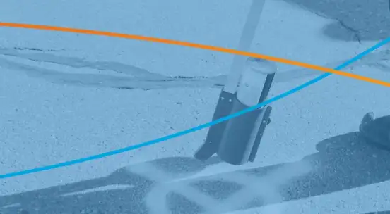
TerraFlow Mobile enables field crews to capture GPS-verified asset locations, attributes, photos, and connectivity in a single workflow. Crews complete the entire documentation process on-site using standardized templates with Bluetooth GPS receivers delivering sub-meter to centimeter-level accuracy. When crews install pipe, locate utilities, or perform maintenance, they're creating the as-built record in real-time—not approximating it later from memory.
DataEngine acts as the integration hub between field teams and enterprise systems. Field data synchronizes automatically—the time between field capture and office availability drops from days to minutes. DataEngine provides REST API connectivity to ArcGIS, CAD platforms, and asset management systems without manual re-entry.
Pre-configured templates ensure data consistency across your entire organization, enforcing specific data quality requirements and making all record capture accurate, repeatable, and reliable.
Real Results
With TerraFlow providing field-verified data, digital twins deliver on their promise. PVS Contractors documented 42% staff time reduction for a 1,000 km gas transmission survey because TerraFlow Mobile automated data capture and geoprocessing. One environmental remediation client has run their program continuously for 2.5+ years, with their senior engineer stating: "We could not execute the work required without the software and support."
Premier Locates implemented TerraFlow Mobile with immediate field deployment. Their Geomatics Manager noted: "TerraFlow is at the leading edge of the industry change...the ability to customize is impressive."
For utility owners, accurate topology enables reliable network traces, verified asset locations support predictive maintenance, and real connectivity data powers scenario analysis you can trust. For locate contractors, walk-back functionality means returning to exact previous positions without re-locating from scratch, while timestamped georeferenced records protect you when questions arise.
The Bottom Line
Spending $2 trillion on grid modernization won't deliver results if digital twins are built on legacy data showing transformers blocks away from actual locations. The foundation must be accurate—capturing field-verified data at the moment infrastructure is installed, maintained, or located.
TerraFlow's integrated field platform turns your field crews' daily work into the authoritative data source your digital twin requires. Every locate, installation, and maintenance interaction becomes an opportunity to verify and improve infrastructure records.
The utilities that succeed in digital transformation won't deploy the most sophisticated AI—they'll be the ones who recognized that accurate, field-verified base data is the foundation making everything else possible.
Ready to build the accurate foundation your digital transformation requires? Learn how TerraFlow integrates GPS-verified data collection into daily operations. Visit www.terraflow.ca or DM me to discuss your modernization challenges.
#UtilityIndustry #DigitalTwin #GridModernization #GIS #UtilityMapping #DamageControl #Infrastructure #DataQuality