The Locate Data Your Utility Is Throwing Away Every Day
)
Every utility in North America has the same quiet problem. The people who manage the GIS records know the data isn’t accurate. The field crews know the records don’t match what’s actually in the ground. The operations team knows that damage incidents are disproportionately linked to areas where records are outdated. And yet, the problem persists.
It persists because fixing utility records has always been treated as a project rather than a process — something that requires a dedicated budget, a separate team, and a defined timeline. Records remediation projects are expensive, slow, and produce a snapshot that begins decaying the moment the project ends.
But there is a fundamentally different way to think about this problem, and a small number of utilities and locate contractors are already using it. Instead of treating records accuracy as a project to be completed, they are treating it as a byproduct of normal operations — a continuous feedback loop where every completed locate makes the GIS more accurate, automatically.
The Scope of the Problem
To understand why this matters, consider the scale of what’s underground. Private utilities alone represent roughly 60 percent of all buried infrastructure across North America, and much of it is poorly documented or entirely undocumented. Municipalities and utilities that have been operating for decades often have records that reflect the state of their network as it existed years or even decades ago, with limited updates since.
Lines get relocated. New services get installed. Facilities get abandoned but remain in the records as though they’re still active. Emergency repairs are completed and never documented. The result is a progressive divergence between what the GIS shows and what’s actually in the ground.
This divergence creates real, measurable consequences. When a locator arrives on site with inaccurate records, their ability to perform a quality locate is compromised from the start. They’re looking for utilities in locations where the records say they should be, rather than where they actually are. This leads to incomplete locates, missed utilities, and the kind of near-misses that don’t show up in damage statistics but erode the safety margin every day.
The Data You Already Have — And Are Discarding
Here is the part that should frustrate every GIS manager: the data needed to improve these records is already being collected. It’s being collected every single day, on every single locate.
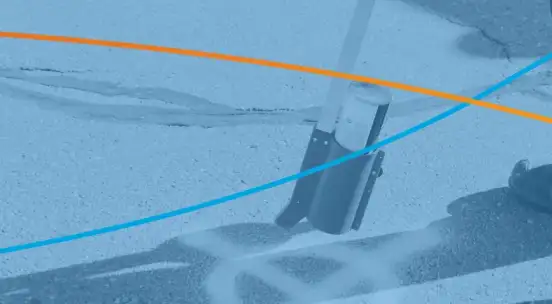
Every time a locator goes to a site and identifies the location of buried utilities, they are generating field-verified intelligence about the actual state of the underground infrastructure. They’re confirming where utilities are, identifying where the records were wrong, discovering unmarked facilities, and noting changes that have occurred since the last time anyone looked.
In most operations, all of that intelligence disappears the moment the ticket is closed. The locate is completed, the positive response is filed, and the field data — the GPS-accurate, field-verified, real-time intelligence about what’s actually underground — goes into a filing cabinet, a PDF, or simply evaporates.
Multiply this by thousands of locates per year on a single utility’s network, and the amount of wasted intelligence is staggering. Every one of those locates was an opportunity to update the GIS. Instead, the data was collected, used once for the immediate purpose, and discarded.
Closing the Locate-to-Record Loop
The utilities and contractors that have solved this problem didn’t launch a records remediation project. They changed how locate data flows through their organization.
In a closed-loop system, the field data captured during a locate — GPS coordinates, depth readings, utility identification, photographic documentation — is automatically structured and formatted to update the facility record. When a locator completes a job, the system doesn’t just close the ticket. It feeds the field-verified data back into the GIS, adding or correcting the record based on what was actually found in the ground.
No manual data entry. No separate QA step. No GIS technician re-keying field notes into the mapping system. The record updates itself as a byproduct of the work that was already being done.
The effect compounds over time. After a year of locates flowing back into the GIS, the records in high-activity areas are dramatically more accurate than they were at the start. After two years, the utility has a fundamentally different quality of facility data — not because they ran a remediation project, but because they stopped throwing away the intelligence their field operations were already generating.
The Risk Reduction Effect
Improved records accuracy has a direct, measurable impact on damage prevention. When locators arrive on site with accurate records, their locates are more complete, more efficient, and more likely to identify all buried utilities. Damage rates decrease. Restaking rates decrease. Liability exposure decreases.
There is also a regulatory dimension. As documentation and compliance requirements intensify across the industry, utilities that can demonstrate a systematic approach to records accuracy are in a stronger position during audits and damage investigations. They can show not just what their records say, but how those records are being continuously validated and improved by real field data.
The contrast with the traditional approach is stark. A utility running a records remediation project every five to ten years gets a snapshot that decays immediately. A utility with a closed-loop locate-to-record system gets a living dataset that improves continuously. One is a cost center. The other is an investment that compounds.
What This Means for Your Organization
If you manage utility records and you know they’re not as accurate as they should be, you are not alone. Virtually every utility in North America faces this challenge. The question is whether you continue to treat it as a periodic project that produces a decaying snapshot, or whether you build a system that makes your records better as a natural consequence of normal operations.
The data to improve your GIS already exists. It’s being collected by your locators, on your network, every day. The only question is whether you’re going to use it.