Understanding GPS Quality: How to Know If Your Position Data Is Reliable
)
By TerraFlow Geomatics
Your GPS receiver says it has a fix. But how good is that fix, really?
A position that looks accurate on screen might be off by several meters. When you're building records that others will rely on for years, that gap matters.
Every GNSS receiver reports quality information alongside its position data. You just need to know how to read it.
This article breaks down three key indicators — fix type, Dilution of Precision (DOP), and estimated accuracy — so your teams can make informed decisions about when to trust their data.
Fix Type: What Kind of Solution Are You Getting?
Every GNSS receiver reports a quality indicator as part of its position output. This value comes from the NMEA GGA sentence, which is the standard communication protocol used by virtually all GPS equipment (NMEA 0183 Standard; Lefebure, 2024; Racelogic, 2024).
The quality indicator is a single number that tells you what type of position solution the receiver has calculated. Here's what each value means and what it means for your field work.
0 — Invalid (No Fix)
No position calculated. Happens indoors, in deep urban canyons, or during startup. Do not capture data.
1 — GPS Fix (SPS / Autonomous)
Satellite signals only, no external corrections. Accuracy typically 2 to 5 meters under good conditions. Acceptable for general navigation but understand the limitations for record-quality work.
2 — DGPS Fix (Differential GPS)
Corrections applied from a base station or augmentation system such as WAAS or EGNOS. Accuracy roughly 1 to 3 meters. A meaningful improvement and often sufficient for standard utility locating.
4 — RTK Fixed (Real-Time Kinematic, Fixed Solution)
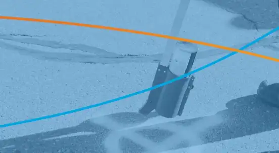
Highest-precision real-time solution available. Carrier phase ambiguities resolved as integers, delivering centimetre-level accuracy (typically 1–3 cm horizontally). This is the target for as-built capture and subsurface utility engineering. Systems like the Radiodetection 8200SG, Vivax Metrotech RTK Pro, and external receivers from EOS or Trimble can deliver this when connected to an appropriate correction source.
5 — RTK Float
RTK corrections received but carrier phase ambiguities not fully resolved. Sub-metre accuracy — better than DGPS but not as reliable as fixed. Often occurs during convergence or in marginal signal conditions.
6 — Dead Reckoning (Estimated)
Position estimated from last known fix combined with motion sensors. Degrades rapidly. Not suitable for data capture.
Practical Takeaway: For most utility locating work, you want a quality indicator of 2 or higher. For precision as-built capture, aim for 4 (RTK Fixed). If your receiver reports 1 or lower, pause and troubleshoot before capturing permanent records.
Dilution of Precision: How Satellite Geometry Affects Accuracy
Fix type tells you what corrections your receiver is using. But there's a second factor that impacts position quality — the physical arrangement of satellites your receiver can see.
This is measured by Dilution of Precision, or DOP.
DOP is essentially an error multiplier. Even with strong signals and good corrections, if satellites are clustered in one part of the sky, accuracy degrades. When they're well spread, DOP is low and your position is reliable. When they're bunched together, accuracy suffers (Penn State GEOG 862; Wikipedia, "Dilution of Precision").
Types of DOP
Your receiver may report several types of DOP (Penn State GEOG 862; Tersus GNSS):
HDOP (Horizontal) — Accuracy of your latitude and longitude. Most relevant for utility locating where horizontal position matters most.
VDOP (Vertical) — Accuracy of your altitude. Less critical for most utility work, but relevant if recording elevation data.
PDOP (Position) — Combines horizontal and vertical into a single 3D value. Many receivers report this as their primary metric. Mathematically: PDOP² = HDOP² + VDOP².
GDOP (Geometric) — The most comprehensive measure, incorporating position and time accuracy. Primarily used in system-level analysis.
Reading DOP Values
Lower DOP values are better. Here's how to interpret them (Isik et al., 2020; Penn State GEOG 862):
Under 2 — Excellent. Highly reliable positioning. Suitable for all precision applications.
2 to 5 — Good. Accurate for most utility locating and record capture. This is the range you'll see most often under normal conditions.
5 to 10 — Moderate. Acceptable for general navigation. Use caution for record-quality capture.
10 to 20 — Poor. Position data is unreliable for record keeping. Wait for conditions to improve.
Over 20 — Very poor. Do not use.
A common PDOP mask setting is 6, meaning the receiver won't log data above that threshold (Penn State GEOG 862). For precision as-built capture, consider tightening to 4 or lower.
The Receiver's Accuracy Estimate: What That Number Actually Means
Beyond fix type and DOP, most GNSS receivers display an estimated position accuracy — something like "Est. Accuracy: 0.03m" or "EPE: 2.4m."
This number is useful. But it's widely misunderstood.
How It's Calculated
The receiver combines DOP (satellite geometry) with its internal assessment of ranging errors to produce a predicted uncertainty. The general relationship is: Estimated Position Error = DOP × User Equivalent Range Error (van Diggelen, 2007; gpsinformation.net).
The result is a radius within which your true position is predicted to fall, at a stated confidence level.
The Confidence Level Problem
Not all receivers report accuracy the same way. The number on your screen could represent different statistical measures (van Diggelen, 2007; Juniper Systems):
CEP (Circular Error Probable) — 50% of positions fall within this radius. Half your readings could be outside the stated accuracy. Some consumer-grade receivers use this.
HRMS (Horizontal Root Mean Square) — Approximately 63% of positions fall within this radius. Some professional field software uses this convention.
2DRMS (Twice Distance Root Mean Square) — 95 to 98% of positions fall within this radius. The most common standard for professional survey-grade equipment.
R95 (95th Percentile) — 95% of positions fall within this radius, calculated directly from measured data.
The practical impact is significant. A receiver displaying "accuracy: 1.0m" using CEP is making a very different claim than one displaying "accuracy: 1.0m" using 2DRMS. The first means half your points might exceed a metre of error. The second means 95% or more will be within a metre.
If your receiver doesn't clearly state which method it uses, check the documentation.
Estimates Are Not Guarantees
The accuracy value on your screen is a prediction based on the receiver's internal model. It is not a measured error against a known point.
Research has shown that receivers can overestimate their own accuracy — reporting high confidence while actual errors are larger than expected (Interpine, 2016; George, 2024). This tends to happen in challenging environments where multipath, signal reflections, and atmospheric conditions introduce errors the model doesn't fully account for.
Use the estimated accuracy as a relative indicator. When the number is stable and low, conditions are good. When it spikes or fluctuates, something is degrading your position. Treat it as a flag, not a guarantee.
Putting It Together in the Field
Fix type, DOP, and estimated accuracy work together to give you a complete picture of position quality.
A receiver reporting RTK Fixed (quality indicator 4) with an HDOP of 1.2 and an estimated accuracy of 0.02m is giving you its best possible output. Capture with high confidence.
A receiver reporting a basic GPS Fix (quality indicator 1) with an HDOP of 8.0 and an estimated accuracy of 4.5m is telling you three things are working against you — no corrections, poor satellite geometry, and the receiver itself is flagging low confidence. That data should not go into your permanent records.
Field applications designed for utility work, such as TerraFlow Mobile, display these quality metrics in real time so crews can make informed decisions before capturing data. This visibility matters because once bad data enters your records system, it's difficult to identify and correct after the fact.
Practical Steps for Your Team
Check before you capture. Verify fix type, DOP, and estimated accuracy before logging position data.
Set appropriate masks. Configure your receiver to reject data below a quality threshold. PDOP mask of 6 is a reasonable starting point.
Understand your environment. Urban canyons, tree canopy, and buildings degrade satellite geometry. If DOP is high, move to a more open area or wait.
Flag marginal data. If you must capture at lower quality, document it. A note beats a position that looks precise but might not be.
Verify at startup. Don't capture data before the receiver has stabilized.
Why This Matters for Your Records
The positions you capture today will be used by other locators, engineers, and excavators for years. Understanding GPS quality indicators ensures the records you're building are accurate, repeatable, and reliable.
When your teams can distinguish between a centimetre-accurate RTK Fixed position and a 5-metre autonomous GPS fix, they make better decisions about when to capture and when to wait.
That discipline is what separates good digital records from digital records that create the same confusion as the paper systems they replaced.
Sources
- NMEA 0183 Standard — GGA Sentence Format. As documented by Lefebure (2024), lefebure.com/articles/nmea-gga; and Racelogic SatGen Documentation (2024), en.racelogic.support
- GPSD Project — "NMEA Revealed." gpsd.gitlab.io/gpsd/NMEA.html
- Isik, O.K., Hong, J., Petrunin, I., & Tsourdos, A. (2020). "Integrity Analysis for GPS-Based Navigation of UAVs in Urban Environment." Robotics, 9(3), 66. doi:10.3390/robotics9030066
- Penn State GEOG 862 — "GPS and GNSS for Geospatial Professionals: Dilution of Precision." e-education.psu.edu/geog862/node/1771
- Langley, R.B. (1999). "Dilution of Precision." GPS World, May 1999. University of New Brunswick.
- Wikipedia — "Dilution of Precision (Navigation)." en.wikipedia.org/wiki/Dilution_of_precision_(navigation)
- Tersus GNSS — "What is DOP in GNSS." tersus-gnss.com/tech_blog/what-is-dop-in-gnss
- van Diggelen, F. (2007). "GNSS Accuracy: Lies, Damn Lies, and Statistics." GPS World, 18(1), pp. 26–32.
- Juniper Systems — "GNSS/GPS Accuracy Explained." junipersys.com/support/article/6614
- gpsinformation.net — "Error Measures: What Do They Mean?" and "EPE." gpsinformation.net/main/errors.htm
- Interpine Innovation (2016). "GPS Accuracy Estimate (EPE) — What Is It?" interpine.nz
- George, M. (2024). "GNSS Accuracy Estimates." medium.com/@mikeg888/gnss-accuracy-estimates
TerraFlow Geomatics provides field automation platforms for utility locating and infrastructure records management. For more information about GPS-enabled locating solutions, visit terraflowgeomatics.com.